This page best viewed with

A Book By CM. Click To Get A Copy

OnePlusYou Quizzes and Widgets
Created by OnePlusYou

No Rights Reserved. Take Anything You Want, But If You Steal Any Text Link To Here.

Send Your Hate Mail To

........

Greed:High
 
Gluttony:High
 
Wrath:Low
 
Sloth:Very High
 
Envy:Low
 
Lust:High
 
Pride:High
 

Take the Seven Deadly Sins Quiz

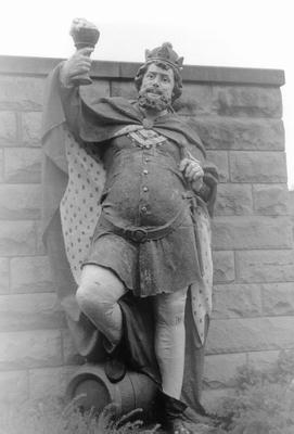
King Gambrinus - Patron Saint of beer.

Wednesday, December 12, 2007

It Ain't Over Till The Fat Lady Sings

And that fat lady has a name. Olga. I really hate to say this because I do not know who reads this blog and I once knew a hot chick who was named Olga, but to me Olga is a "fat" name.

But in this case, Olga is not a person. Olga is a "thing".

Yes, another December Tropical Storm. It has a 10% chance of being a hurricane in 72 hours. But most likely it will dissipate, or remain a tropical storm. The water is warm enough for development, but the air currents are not favorable for this to happen.

But not to worry! There is no evidence at all of climate change. Al Gore made it all up. The climate scientists are in on the scam too, getting all sorts of kickbacks from the clean energy industry.

OH WAIT! There is no real "clean energy" industry, and therefore no kickbacks. Never mind that.

The storm will remain to the south. It will not deviate greatly from the forecast path. At least I do not think it will. The air currents are just not going to let it go north. A high pressure front is sweeping into Florida. Ahhhh....nice cool air. Got to love it.

But it is all and well that it will remain south. See the boat parade thing is supposedly not canceled because of weather. And it would totally SUCK to have to be on my open boat for that.

More good news is that the thing will probably loose strength, so it has done its worst already. But it went over the Dominican Republic and Haiti. Haiti is dirt poor, and the Dominican Republic is not exactly a wealthy nation either. I am sure that even just the minimal tropical storm conditions messed some people up. And there is no FEMA in Haiti - for better or worse. But when it gets to Mexico, it will just be crappy weather. Nothing too bad, except for some rain.
Some people that read this blog from the frozen north who may or may not have planned a cruise leaving from Ft. Lauderdale should be happy that Olga did not show up around the time that some big boat is scheduled to set sail with them on board.

Last hurricane season saw the Greek alphabet used. There was even a late season "sub tropical" named storm (sub tropical storms have a "cold core", whatever the hell that means).

This season saw a named storm early - before the season was supposed to begin (another of those "cold core" sub tropical storms). The rest of the season was fairly normal - actually slightly above normal, but well within previous observations. There is strong evidence that active hurricane seasons run in cycles. There were 2 major (cat 5) storms. The ACE (accumulated cyclone energy) index however was well below predictions. The storms that did form were weak and mostly short lived. Even with the two category 5 storms, the ACE index was low.

But screwy stuff is going on. And Olga is your proof. In two years, this is the third named storm formed in the tropics OUT of hurricane season.

Labels:

Tuesday, October 30, 2007

Got More Stuff

EXCITING NEWS! I ordered the Aquapod 12 gallon HQI aquarium. The Aquapod is an "all in one" design, with a false back that includes an overflow and space to put filter media.

The HQI part means it comes with no top and a 70 watt metal halide lamp with a color temperature of 14,000 kelvins. The higher the color temperature, the cooler the light is. This means more blue. 10,000 kelvins is considered to be perfectly white. I think. So lower than 10,000 means more yellow / red and higher means more blue. 14,000 kelvins will simulate water at a depth of 10 to 15 feet. Perfect for a lot of stuff. 12 gallons with 70 watts of light means almost 6 watts per gallon - plenty of light for some fancy stuff. Like corals. When I set it up, most likely it will be saltwater. What the hell.

The tank has no canopy. It is an open design. I may get a glass lid for it to slow down evaporation. Or keep it open. Halide lights generate a lot of heat, but with no cover the heat will not be trapped.

Photos of the thing will be posted as soon as it arrives. I already know that a few modifications are needed. It will be fun to design the modifications.

So now I feel a little better about the death of the cell phone. I have insurance on the thing (I forgot that I had it) so I will be making a claim. The replacement phone I want will cost $150 after all the discounts and stuff. But I will try to get that lowered by making an insurance claim.

Depending on how much they give me for my claim - I will either retain the insurance or tell them to keep the claim offer, convert it to Mexican pennies, and cram it all up their ass. And of course drop all insurance. If all they offer is a measly $10 or $20 then what is the point? What the hell is the $3 or so a month for insurance for? I should at least get $100. At least. Maybe even enough to get the $150 phone for free.

I just love fighting with a company over insurance claims. Something tells me this is going to be a pain in my ass.

So I ordered the tank to make me feel better. I do feel a little better.

But this could be due to the Sierra Nevada Pale Ale I bought today. I have been out of beer for at least 2 weeks. I was just not motivated to get any.

The Tropical Storm will NOT hit Florida. The cone is shifting to the west (towards FL) but it will not hit. I wish it would - Central FL really needs the water. In fact, the storm needs to make landfall and stall out over Central Florida, then move SLOWLY up the coast dumping rain along the way. Atlanta is about out of water, as is Fuzz.


But whatever - it is not going to hit Florida. It will move out to sea, and die once it gets into colder water. After it rains on The Bahamas - it will only be a threat to ships at sea.

Labels: , ,

Saturday, August 18, 2007

Forecasting, Guessing, Can Not Get A Decent Phone In The USA

This whole Dean thing is getting downright spooky. Someone is going to get hit, and they will get hit HARD. Big time hard. I am afraid that the island nation of Jamaica is going to see the worst of it. Jamaica and the Grand Cayman Islands. Or should I say THE Grand Cayman Island. Little Cayman and Cayman Brac will likely not see the absolute worst of the storm. But they will still see some bad conditions.

So why the rather gloomy outlook? The forecast track just keeps looking worse and worse. Here is how I base my guess. First, the forecast track from the NWS.

Now notice how the track has not changed significantly over the past few days. The track did jog slightly to the north, but not by much. Yesterday the track had it just to the south of Jamaica till the 11 PM update. Since then it has it going right over the island nation. The jog to the north is not at all significant. At the current speed the storm is moving, Jamaica will be feeling the effects well before 48 hours.

Now here is what I found to be the worst. The wind probability table. This table you have to pay attention to. You have to watch it over time and see how it changes - if it changes. So here is the 5 PM wind probability table.

So according to this table, in the next 24 - 36 hours, the chance of the storm bring a category 4 or 5 is 50%. The chance of category three winds are 40% for the next 24 hours, and 33% in the next 36 hours. And look at the 12 hour prediction. 50% for category 4 or 5, 45% for category 3, and 5% for category 2. The storm is already at category 3 by the way. The table over the past few days has been following a pattern - the odds of a 4 or 5 keep going up.

We can therefore conclude that the storm will be a category 4 or even 5 by the time it gets to Jamaica. VERY bad news for them indeed. This is starting to look like another Hurricane Gilbert. It is on an almost identical track as Gilbert. Gilbert was the second most intense hurricane observed, with Wilma taking top honors. Gilbert became a cat 5 storm after it left Jamaica, Dean could hit Jamaica as a 5. It very well could.

Now you may have noticed that the above table is from the Friday 5 PM update. So what about the Friday 11 PM update? Way ahead of you all here.

All NA? What the hell is up with that? Now this is the really scary part. Why would the computers suddenly come up with this result? And why would the NWS change their official published data to what amounts as "I have no idea"? Odds of a major storm have gone up and up. So what are the forecast models really saying now? NA? Not available? I do not buy it. I hope people under the gun are taking this seriously and are not underestimating what they are in for. This storm will cause major damage.

So, what the hell is up with the post title saying I can not get a decent phone in the USA? Why would I say that? Well lets see. Still thinking......still thinking.....OK I got it!

This photo of a flower was taken by Jane on a 2 megapixel CELL PHONE CAMERA! Can you believe that? A cell phone camera. My cell phone camera sucks ass. It is almost useless. It takes the worlds worst digital photos.

Apparently, I have to go the UK to get a decent phone with a usable camera.

Labels: ,

Thursday, August 16, 2007

The Problem With Dean

DEAN UPDATE!

Now I know, you are all wondering "are you in the cone of death yet Lazy?"

Well the answer is yes. And no. Both at the same time. So how is this possible? Through the magic of guessing! I mean forecasting. Forecasting is not the same as guessing right? Of course it is. Except it is not a blind guess. It is a guess based on the best evidence available at the time. And if that evidence changes? Well the forecast changes. So anyway, without further to do - I present the most recent cone of death!


This cone of death is cool because it is in color. I like colors. The colors correspond to probability. Probability of tropical storm force winds. As you can see, the Florida Keys are in the 10% - 20% probability range. I am also in the 10% - 20% cone, but just barely. The rest of my general area is in the 5% - 10% probability cone for tropical storm force winds. Now what do you do when you are in a cone of death? Why, you look at another cone of death! You may like that one better. You may not be in that one. For example.


Now notice how this cone totally leaves out Florida. I like this one much better. The bad thing is people in Jamaica probably think this cone sucks. I do not blame them for thinking this. I hope that if Jamaica is to be hit, it is not hit very hard. Nobody wants a hurricane to hit them, but at the same time nobody really wants it to hit someone else either.

But, my Iguana Sense is not tingling. Nothing is tingling. At this point I can just not worry about it. I do not think it is going to effect South Florida. Someone is going to get hit - just not me. Not this time. It is possible - but I am going on record now with my guess. It will stay well south of Florida. So there. I will either be right or wrong. Who knows which, it is just a guess. It COULD shift north after all. I just do not think it will. But we shall see. One way or another.

Really - this is terrible timing. Of course it is never a good time to get a hurricane in your area, but whatever. I made plans to go out in the boat this weekend! But of the weather is shitty, I can not do this. I will have to make alternate plans. Which may be possible. At least I will make every attempt to make it possible - without sounding all creepy and stuff. I always have a backup plan or two for some things.

Labels: , ,

Wednesday, August 15, 2007

Housekeeping

I need a button that says "housekeeping". That way I can press it whenever I need something cleaned, but I am too lazy to do it myself. Which is 99% of the time.

But anyway, I just did a little blog housekeeping. Mostly with my blog links. I added some, and removed some.

And I cleaned up the playlist thing a little. I removed some songs, and added others. And I am not done yet. Oh no. I want to add even more stuff.

And I better hurry! Because today I was alerted about some sort of storm or such crap that is "out there". Now here is the funny part. I had no idea about it. A storm? Out there? Really? I see no storm clouds! I think you are on drugs.

Except the people were not on drugs. And this is where it gets funny. So pay attention here. The people were extended family visiting Deerfield Beach from Ohio and Mississippi. Got that? OHIO! When was the last time Ohio was hit by a hurricane? Huh? Never - that is when. Oh yea they might THINK they "got hit" because what was once a mighty hurricane passed over them and dumped some rain. But the fact is that 0 hurricanes have hit Ohio in the past 50 million years. And the family from Mississippi? They live nowhere near a beach. They are way up in north Mississippi - on the other side of the state from the river.

So here I am - a lifelong Florida resident - and they say "did you hear about the hurricane on the way?". And what do I think? I swear this is what I said - "Oh yea! Of course! In fact, I am about to get up and get myself another Hurricane Reef beer! Want one?".

"No really, there is a hurricane out there! It is supposed to be here sometime later this week". Still thinking this is a joke, I say "well that works out well for you! You guys plan to leave Friday right? Good plan by the way, it really sucks to be staying on the beach when the power goes out and a 15 foot storm surge rolls in. Of course, you are staying on the 4th floor".

So today I decide to watch the local news at 10 PM. And sure enough, there is a storm out there. WAY out there. 2,200 miles out there. Closer to Nigeria than Florida. And of course, the local weather goon is already starting to bask in the lime light. Seriously, the news NEVER opens up with the weather goon unless there is a storm out there.


So yea, I should probably watch this thing. But other than that - it is just too far away to really get all excited about it.

Now for all you in places like Ohio and Idaho and Montana and places that never get hurricanes, here is what they are like. They suck. Your electricity WILL go out. And your roof might get ripped off your house. Both these things suck to no end. You see, after a hurricane the air is still. Very still. And it is hot as hell. Except after Wilma. Wilma came in on a cold front - and from the wrong direction. Wilma was a rare and unusual hurricane. It did not matter that much that the power was out. Because the air was nice and cool. Just open the windows and there were NO BUGS and it was colder than the AC is normally at.

But this is not usually the case. The hurricane blows out all your window screens, and no matter how hard the wind blows the mosquitoes manage to hang on. So you get to be all hot and sweaty and the bugs are biting you and life just plain sucks.

And now everyone has a generator. But I have rifles. I swear - I am going to start shooting at the noises. People fire up these darn things and let em run all night. ALL NIGHT! So now your window is open and you are hot and cranky and the bugs are getting you and you get to hear the lovely noise created by all the generators near by.

And of course, these noise makers use up a good deal of gas. At least 5 gallons a day. So every day, idiots line up with gas cans so that they can run the #@%$#@% generator all #@$%#@%$# night. But if I simply place one shot in a generator fuel tank, that will take care of that problem. I think I will use the 7.62x51 rifles for this. But they are not the most accurate. So I might miss the fuel tank and hit other parts of the generator. But I think that the end result will be the same. Quiet.

My generator is quiet. You can hardly hear the darn thing. It cost more than any other 2000 watt generator, but it is quiet. So if you are a cheap asshole with a $150 generator - you suck. Spend some more and get a real generator that I can not hear a block away.

But getting back to Dean, which is just a measly little unimpressive tropical storm right now - I will probably be in stage 1 mode in the next few days. This calls for me pulling the boat out one night and filling it up. And I will also start filling the truck up every time I use 1/8 a tank. That way IF the thing hits and the power is out and it is hard to get gas I will have a full tank, and another 55 gallons in reserve in the boat. Cause I am smart. Everyone else is a flippin moron.

Labels: ,

Saturday, June 02, 2007

And It Begins

So June 1 was the first day of the 2007 Atlantic Hurricane Season.


And on this day, Tropical Storm Barry formed in the Gulf Of Mexico! It is going to hit Florida. Of course. The first named storm of the season formed a few weeks ago, before the official start of the season. It kind of fizzled, but still produced the perfect amount of wind to fan the Florida wild fires - and NO RAIN to put them out. How about that.

Anyway, the 11 PM update had this thing with a 15% chance of going to a category 1 hurricane and a 15% chance of it downgrading to a tropical depression. The 2 AM update has the storm with a 5% chance of going to category 1 status, but it also reduced the probability of it downgrading. So therefore it is safe to conclude that Florida will get a moderate strength tropical storm. Not too bad really. Nor Easters can be just as strong, or even stronger. And from all apparent evidence, this storm will bring rain. That part of the State needs the rain. So while this is going to be a pain in the ass for people, it is going to be more good than bad. At least I think so. Property damage should be minimal for a tropical storm, compared to a category 3 or stronger hurricane!

Really the part of the State that could use the rain the most is the big lake. A LOT of rain needs to fall on the Kissimmee River Basin. This river feeds the big lake. The lake is in bad shape, navigation depth for the lake is under three feet now.

The track also shifted a bit in a strange way. The 11 PM map had the thing shifted slightly more to the north for the FL landfall, and more over water than land off GA and SC. It also had it making landfall at noon today. Not it has it barely inside the State at 8 PM. So it seems to be slowing down. This will cause a greater error track (AKA "Cone Of Death").

But the real important thing is the wind speed prediction forecast. The numbers say it is not expected to get any stronger. Or any weaker. The next update will probably be at 6 AM because of the proximity of the storm to land, but usually it would be at 10 AM.

I think the cone will get shifted more to the south. It is a possibility. I do not think it will be a drastic shift to the south, but I think that it will not hot FL as far to the north as the 2 AM map claims. Remember, I am talking about the center line here. Do not pay attention to that - ANYWHERE in the cone is where they predict the storm to be! So if I am right and the code does shift to the south, it means the prediction is good. A bad prediction would put the storm outside the cone of death by the time the maps are updated again. A lot of people make the mistake of just looking at the center line.

Look at the map and you can see how the NWS has already set up the shift to the south. See that blue line? Areas along that line are under a Tropical Storm Warning. People on this line should expect tropical storm conditions in the next 24 hours. Now notice how that line extends SOUTH of the cone of death, but not west of it? How about that. Now why would they do this?

Conflicting models would explain it. They are getting some models that say shift the cone to the south, but others say no. There could be other factors as well. The NWS is actually very liberal with warnings and watches. If there is any chance a storm could go somewhere they will issue a watch or warning. Watch and warning areas often stray outside the forecast cone of death. But when the warnings are not equally distributed (as in this case) it can mean a cone shift is likely.

A link to the Tropical Prediction Center of the National Weather Service is in the left sidebar, under Iguana Links.

In any case, this is not going to be that horrible. It could be a lot worse. This is a good reminder for everyone to not screw around. This storm will catch people off guard. People will not have shutters, and not have supplies. Some will, but I really think that most people - even those that have shutters -will not put them up. This thing just formed close to land quickly. Nobody had any time.

I hope this thing is cleared out by Sunday.

Labels: ,